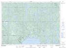
Maps showing Josephine Lake, Sudbury, Ontario
Josephine Lake is a Lake located in Sudbury, Ontario and has an elevation of 298 meters.
- Latitude: 46° 58' 1'' North (decimal: 46.9669444)
- Longitude: 80° 32' 18'' West (decimal: -80.5383333)
- Topography Feature Category: Lake
- Geographical Feature: Lake
- Canadian Province/Territory: Ontario
- Elevation: 298 meters
- Location: Sudbury
- Atlas of Canada Locator Map: Josephine Lake
- GPS Coordinate Locator Map: Josephine Lake Lat/Long