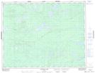
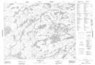
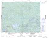
Maps showing Jubilee Lake, Kenora, Ontario
Jubilee Lake is a Lake located in Kenora, Ontario and has an elevation of 398 meters.
- Latitude: 51° 0' 38'' North (decimal: 51.0105555)
- Longitude: 92° 23' 59'' West (decimal: -92.3997222)
- Topography Feature Category: Lake
- Geographical Feature: Lake
- Canadian Province/Territory: Ontario
- Elevation: 398 meters
- Location: Kenora
- Atlas of Canada Locator Map: Jubilee Lake
- GPS Coordinate Locator Map: Jubilee Lake Lat/Long
Jubilee Lake NTS Map Sheets