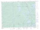
Maps showing Kabenung Hills, Algoma, Ontario
Kabenung Hills is a Mountain located in Algoma, Ontario and has an elevation of 441 meters.
- Latitude: 48° 15' 58'' North (decimal: 48.2661111)
- Longitude: 85° 3' 40'' West (decimal: -85.0611111)
- Topography Feature Category: Mountain
- Geographical Feature: Hills
- Canadian Province/Territory: Ontario
- Elevation: 441 meters
- Location: Algoma
- Atlas of Canada Locator Map: Kabenung Hills
- GPS Coordinate Locator Map: Kabenung Hills Lat/Long
Kabenung Hills NTS Map Sheets