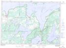
Maps showing Kagawong River, Manitoulin, Ontario
Kagawong River is a River located in Manitoulin, Ontario and has an elevation of 214 meters.
- Latitude: 45° 54' 36'' North (decimal: 45.9100000)
- Longitude: 82° 15' 23'' West (decimal: -82.2563888)
- Topography Feature Category: River
- Geographical Feature: River
- Canadian Province/Territory: Ontario
- Elevation: 214 meters
- Location: Manitoulin
- Atlas of Canada Locator Map: Kagawong River
- GPS Coordinate Locator Map: Kagawong River Lat/Long