Maps showing Kars Creek, Ontario
Kars Creek is a River located in Ontario.
- Latitude: 46° 45' 43'' North (decimal: 46.7619000)
- Longitude: 84° 28' 54'' West (decimal: -84.4817000)
- Topography Feature Category: River
- Geographical Feature: Creek
- Canadian Province/Territory: Ontario
- GPS Coordinate Locator Map: Kars Creek Lat/Long
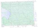
Kars Creek NTS Map Sheets