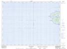
Maps showing Kate Rock, Thunder Bay, Ontario
Kate Rock is a Shoal located in Thunder Bay, Ontario.
- Latitude: 48° 40' 18'' North (decimal: 48.6716666)
- Longitude: 87° 1' 21'' West (decimal: -87.0225000)
- Topography Feature Category: Shoal
- Geographical Feature: Rock
- Canadian Province/Territory: Ontario
- Location: Thunder Bay
- Atlas of Canada Locator Map: Kate Rock
- GPS Coordinate Locator Map: Kate Rock Lat/Long
Kate Rock NTS Map Sheets