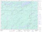
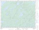
Maps showing Keemle, Thunder Bay, Ontario
Keemle is a Unincorporated area located in Thunder Bay, Ontario.
- Latitude: 49° 45' 2'' North (decimal: 49.7505555)
- Longitude: 87° 11' 46'' West (decimal: -87.1961111)
- Topography Feature Category: Unincorporated area
- Geographical Feature: Railway Point
- Canadian Province/Territory: Ontario
- Location: Thunder Bay
- Atlas of Canada Locator Map: Keemle
- GPS Coordinate Locator Map: Keemle Lat/Long
Keemle NTS Map Sheets