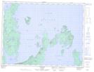
Maps showing Keezis Point, Thunder Bay, Ontario
Keezis Point is a Cape located in Thunder Bay, Ontario and has an elevation of 273 meters.
- Latitude: 49° 34' 27'' North (decimal: 49.5741666)
- Longitude: 88° 42' 7'' West (decimal: -88.7019444)
- Topography Feature Category: Cape
- Geographical Feature: Point
- Canadian Province/Territory: Ontario
- Elevation: 273 meters
- Location: Thunder Bay
- Atlas of Canada Locator Map: Keezis Point
- GPS Coordinate Locator Map: Keezis Point Lat/Long