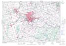
Maps showing Kent Drain, Brant, Ontario
Kent Drain is a Hydraulic construction located in Brant, Ontario and has an elevation of 254 meters.
- Latitude: 43° 0' 55'' North (decimal: 43.0152777)
- Longitude: 80° 26' 32'' West (decimal: -80.4422222)
- Topography Feature Category: Hydraulic construction
- Geographical Feature: Drain
- Canadian Province/Territory: Ontario
- Elevation: 254 meters
- Location: Brant
- Atlas of Canada Locator Map: Kent Drain
- GPS Coordinate Locator Map: Kent Drain Lat/Long
Kent Drain NTS Map Sheets