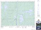
Maps showing Kerry Creek, Timiskaming, Ontario
Kerry Creek is a River located in Timiskaming, Ontario.
- Latitude: 47° 25' 14'' North (decimal: 47.4205555)
- Longitude: 80° 15' 37'' West (decimal: -80.2602777)
- Topography Feature Category: River
- Geographical Feature: Creek
- Canadian Province/Territory: Ontario
- Location: Timiskaming
- Atlas of Canada Locator Map: Kerry Creek
- GPS Coordinate Locator Map: Kerry Creek Lat/Long
Kerry Creek NTS Map Sheets