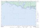
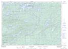
Maps showing Killarney Provincial Park, Sudbury; Manitoulin, Ontario
Killarney Provincial Park is a Conservation area located in Sudbury; Manitoulin, Ontario and has an elevation of 232 meters.
- Latitude: 46° 6' 2'' North (decimal: 46.1005555)
- Longitude: 81° 22' 52'' West (decimal: -81.3811111)
- Topography Feature Category: Conservation area
- Geographical Feature: Provincial Park
- Canadian Province/Territory: Ontario
- Elevation: 232 meters
- Location: Sudbury; Manitoulin
- Atlas of Canada Locator Map: Killarney Provincial Park
- GPS Coordinate Locator Map: Killarney Provincial Park Lat/Long
Killarney Provincial Park NTS Map Sheets