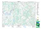
Maps showing Kilmarnock Island, Grenville, Ontario
Kilmarnock Island is a Island located in Grenville, Ontario and has an elevation of 113 meters.
- Latitude: 44° 52' 21'' North (decimal: 44.8724999)
- Longitude: 75° 56' 10'' West (decimal: -75.9361111)
- Topography Feature Category: Island
- Geographical Feature: Island
- Canadian Province/Territory: Ontario
- Elevation: 113 meters
- Location: Grenville
- Atlas of Canada Locator Map: Kilmarnock Island
- GPS Coordinate Locator Map: Kilmarnock Island Lat/Long
Kilmarnock Island NTS Map Sheets