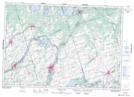
Maps showing King Bay, Peterborough, Ontario
King Bay is a Bay located in Peterborough, Ontario and has an elevation of 198 meters.
- Latitude: 44° 28' 10'' North (decimal: 44.4694444)
- Longitude: 77° 50' 6'' West (decimal: -77.8349999)
- Topography Feature Category: Bay
- Geographical Feature: Bay
- Canadian Province/Territory: Ontario
- Elevation: 198 meters
- Location: Peterborough
- Atlas of Canada Locator Map: King Bay
- GPS Coordinate Locator Map: King Bay Lat/Long
King Bay NTS Map Sheets