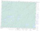
Maps showing Kingswood Lake, Thunder Bay, Ontario
Kingswood Lake is a Lake located in Thunder Bay, Ontario and has an elevation of 468 meters.
- Latitude: 49° 21' 59'' North (decimal: 49.3663888)
- Longitude: 89° 43' 4'' West (decimal: -89.7177777)
- Topography Feature Category: Lake
- Geographical Feature: Lake
- Canadian Province/Territory: Ontario
- Elevation: 468 meters
- Location: Thunder Bay
- Atlas of Canada Locator Map: Kingswood Lake
- GPS Coordinate Locator Map: Kingswood Lake Lat/Long
Kingswood Lake NTS Map Sheets