Canada Topographic Maps

Knicely Topo Maps

Topography maps and Latitude/Longitude Location

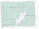
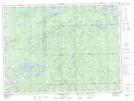
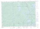
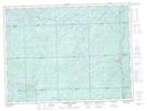
Maps showing Knicely, Algoma, Ontario

Knicely is a Geographical area located in Algoma, Ontario.

  • Latitude: 48° 14' 6'' North   (decimal: 48.2350000)
  • Longitude: 84° 59' 23'' West   (decimal: -84.9897222)
  • Topography Feature Category: Geographical area
  • Geographical Feature: Geographic Township
  • Canadian Province/Territory: Ontario
  • Location: Algoma
  • Atlas of Canada Locator Map: Knicely
  • GPS Coordinate Locator Map: Knicely Lat/Long

Knicely NTS Map Sheets

042C02 Hawk Junction Topographic Map at 1:50,000 scale

042C03 Mishibishu Lake Topographic Map at 1:50,000 scale

042C06 Pokei Lake Topographic Map at 1:50,000 scale

042C07 Medhurst Creek Topographic Map at 1:50,000 scale

042C White River Topographic Map at 1:250,000 scale

 
Buy Topographic Maps DVD
Newsletter Sign-up

Yes, I want to receive map store discounts.


Bookmark and Share