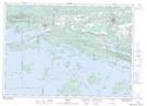
Maps showing La Cloche Creek, Algoma; Sudbury, Ontario
La Cloche Creek is a River located in Algoma; Sudbury, Ontario and has an elevation of 216 meters.
- Latitude: 46° 10' 17'' North (decimal: 46.1713888)
- Longitude: 82° 5' 31'' West (decimal: -82.0919444)
- Topography Feature Category: River
- Geographical Feature: Creek
- Canadian Province/Territory: Ontario
- Elevation: 216 meters
- Location: Algoma; Sudbury
- Atlas of Canada Locator Map: La Cloche Creek
- GPS Coordinate Locator Map: La Cloche Creek Lat/Long
La Cloche Creek NTS Map Sheets