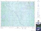
Maps showing Laforest, Sudbury, Ontario
Laforest is a Unincorporated area located in Sudbury, Ontario and has an elevation of 400 meters.
- Latitude: 47° 1' 55'' North (decimal: 47.0319444)
- Longitude: 81° 12' 46'' West (decimal: -81.2127777)
- Topography Feature Category: Unincorporated area
- Geographical Feature: Dispersed Rural Community
- Canadian Province/Territory: Ontario
- Elevation: 400 meters
- Location: Sudbury
- Atlas of Canada Locator Map: Laforest
- GPS Coordinate Locator Map: Laforest Lat/Long