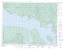
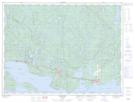
Maps showing Lahontan, Thunder Bay, Ontario
Lahontan is a Geographical area located in Thunder Bay, Ontario.
- Latitude: 48° 51' 47'' North (decimal: 48.8630555)
- Longitude: 87° 29' 9'' West (decimal: -87.4858333)
- Topography Feature Category: Geographical area
- Geographical Feature: Geographic Township
- Canadian Province/Territory: Ontario
- Location: Thunder Bay
- Atlas of Canada Locator Map: Lahontan
- GPS Coordinate Locator Map: Lahontan Lat/Long
Lahontan NTS Map Sheets