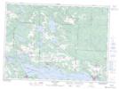
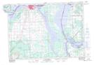
Maps showing Laird, Algoma, Ontario
Laird is a Geographical area located in Algoma, Ontario and has an elevation of 214 meters.
- Latitude: 46° 24' 8'' North (decimal: 46.4022222)
- Longitude: 84° 2' 43'' West (decimal: -84.0452777)
- Topography Feature Category: Geographical area
- Geographical Feature: Geographic Township
- Canadian Province/Territory: Ontario
- Elevation: 214 meters
- Location: Algoma
- Atlas of Canada Locator Map: Laird
- GPS Coordinate Locator Map: Laird Lat/Long
Laird NTS Map Sheets