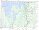
Maps showing Lake Nipigon Provincial Park, Thunder Bay, Ontario
Lake Nipigon Provincial Park is a Conservation area located in Thunder Bay, Ontario and has an elevation of 304 meters.
- Latitude: 49° 28' 55'' North (decimal: 49.4819444)
- Longitude: 88° 7' 39'' West (decimal: -88.1275000)
- Topography Feature Category: Conservation area
- Geographical Feature: Provincial Park
- Canadian Province/Territory: Ontario
- Elevation: 304 meters
- Location: Thunder Bay
- Atlas of Canada Locator Map: Lake Nipigon Provincial Park
- GPS Coordinate Locator Map: Lake Nipigon Provincial Park Lat/Long