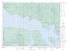
Maps showing Lakeside Shoal, Thunder Bay, Ontario
Lakeside Shoal is a Shoal located in Thunder Bay, Ontario.
- Latitude: 48° 53' 57'' North (decimal: 48.8991666)
- Longitude: 87° 50' 25'' West (decimal: -87.8402777)
- Topography Feature Category: Shoal
- Geographical Feature: Shoal
- Canadian Province/Territory: Ontario
- Location: Thunder Bay
- Atlas of Canada Locator Map: Lakeside Shoal
- GPS Coordinate Locator Map: Lakeside Shoal Lat/Long