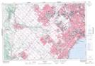
Maps showing Lambton Mills, York, Ontario
Lambton Mills is a Unincorporated area located in York, Ontario and has an elevation of 110 meters.
- Latitude: 43° 39' 22'' North (decimal: 43.6561111)
- Longitude: 79° 30' 45'' West (decimal: -79.5125000)
- Topography Feature Category: Unincorporated area
- Geographical Feature: Urban Community
- Canadian Province/Territory: Ontario
- Elevation: 110 meters
- Location: York
- Atlas of Canada Locator Map: Lambton Mills
- GPS Coordinate Locator Map: Lambton Mills Lat/Long