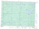
Maps showing Lamming, Algoma, Ontario
Lamming is a Geographical area located in Algoma, Ontario.
- Latitude: 46° 55' 34'' North (decimal: 46.9261111)
- Longitude: 83° 47' 3'' West (decimal: -83.7841666)
- Topography Feature Category: Geographical area
- Geographical Feature: Geographic Township
- Canadian Province/Territory: Ontario
- Location: Algoma
- Atlas of Canada Locator Map: Lamming
- GPS Coordinate Locator Map: Lamming Lat/Long
Lamming NTS Map Sheets