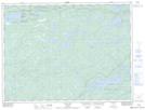
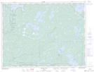
Maps showing Laseine, Rainy River, Ontario
Laseine is a Unincorporated area located in Rainy River, Ontario and has an elevation of 364 meters.
- Latitude: 48° 45' 2'' North (decimal: 48.7505555)
- Longitude: 92° 12' 53'' West (decimal: -92.2147222)
- Topography Feature Category: Unincorporated area
- Geographical Feature: Railway Point
- Canadian Province/Territory: Ontario
- Elevation: 364 meters
- Location: Rainy River
- Atlas of Canada Locator Map: Laseine
- GPS Coordinate Locator Map: Laseine Lat/Long
Laseine NTS Map Sheets