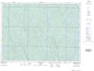
Maps showing Lebell Lake, Sudbury, Ontario
Lebell Lake is a Lake located in Sudbury, Ontario and has an elevation of 401 meters.
- Latitude: 47° 6' 27'' North (decimal: 47.1075000)
- Longitude: 81° 55' 11'' West (decimal: -81.9197222)
- Topography Feature Category: Lake
- Geographical Feature: Lake
- Canadian Province/Territory: Ontario
- Elevation: 401 meters
- Location: Sudbury
- Atlas of Canada Locator Map: Lebell Lake
- GPS Coordinate Locator Map: Lebell Lake Lat/Long
Lebell Lake NTS Map Sheets