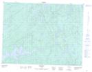
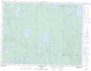
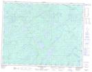
Maps showing Leckie Creek, Thunder Bay, Ontario
Leckie Creek is a River located in Thunder Bay, Ontario and has an elevation of 438 meters.
- Latitude: 49° 3' 34'' North (decimal: 49.0594444)
- Longitude: 88° 52' 59'' West (decimal: -88.8830555)
- Topography Feature Category: River
- Geographical Feature: Creek
- Canadian Province/Territory: Ontario
- Elevation: 438 meters
- Location: Thunder Bay
- Atlas of Canada Locator Map: Leckie Creek
- GPS Coordinate Locator Map: Leckie Creek Lat/Long
Leckie Creek NTS Map Sheets