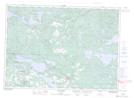
Maps showing Lefroy, Algoma, Ontario
Lefroy is a Geographical area located in Algoma, Ontario.
- Latitude: 46° 18' 49'' North (decimal: 46.3136111)
- Longitude: 83° 38' 58'' West (decimal: -83.6494444)
- Topography Feature Category: Geographical area
- Geographical Feature: Geographic Township
- Canadian Province/Territory: Ontario
- Location: Algoma
- Atlas of Canada Locator Map: Lefroy
- GPS Coordinate Locator Map: Lefroy Lat/Long
Lefroy NTS Map Sheets