Canada Topographic Maps

Leishman Creek Topo Maps

Topography maps and Latitude/Longitude Location

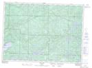
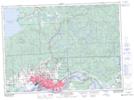
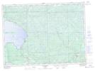
Maps showing Leishman Creek, Ontario

Leishman Creek is a River located in Ontario.

  • Latitude: 46° 45' North   (decimal: 46.7499999)
  • Longitude: 83° 1' West   (decimal: -83.0166999)
  • Topography Feature Category: River
  • Geographical Feature: Creek
  • Canadian Province/Territory: Ontario
  • GPS Coordinate Locator Map: Leishman Creek Lat/Long

Leishman Creek NTS Map Sheets

041J12 Echo Lake Topographic Map at 1:50,000 scale

041K09 Sault Ste Marie Topographic Map at 1:50,000 scale

041K16 Searchmont Topographic Map at 1:50,000 scale

041J Blind River Topographic Map at 1:250,000 scale

041K Sault Ste Marie Topographic Map at 1:250,000 scale

 
Buy Topographic Maps DVD
Newsletter Sign-up

Yes, I want to receive map store discounts.


Bookmark and Share