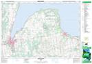
Maps showing Leith, Grey, Ontario
Leith is a Unincorporated area located in Grey, Ontario and has an elevation of 188 meters.
- Latitude: 44° 37' 29'' North (decimal: 44.6247222)
- Longitude: 80° 52' 29'' West (decimal: -80.8747222)
- Topography Feature Category: Unincorporated area
- Geographical Feature: Compact Rural Community
- Canadian Province/Territory: Ontario
- Elevation: 188 meters
- Location: Grey
- Atlas of Canada Locator Map: Leith
- GPS Coordinate Locator Map: Leith Lat/Long
Leith NTS Map Sheets