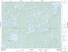
Maps showing Line Bay, Rainy River, Ontario
Line Bay is a Bay located in Rainy River, Ontario and has an elevation of 355 meters.
- Latitude: 49° 5' 00'' North (decimal: 49.0833333)
- Longitude: 93° 30' 17'' West (decimal: -93.5047222)
- Topography Feature Category: Bay
- Geographical Feature: Bay
- Canadian Province/Territory: Ontario
- Elevation: 355 meters
- Location: Rainy River
- Atlas of Canada Locator Map: Line Bay
- GPS Coordinate Locator Map: Line Bay Lat/Long
Line Bay NTS Map Sheets