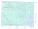
Maps showing Linko, Thunder Bay, Ontario
Linko is a Unincorporated area located in Thunder Bay, Ontario and has an elevation of 487 meters.
- Latitude: 48° 52' 52'' North (decimal: 48.8811111)
- Longitude: 89° 59' 12'' West (decimal: -89.9866666)
- Topography Feature Category: Unincorporated area
- Geographical Feature: Railway Point
- Canadian Province/Territory: Ontario
- Elevation: 487 meters
- Location: Thunder Bay
- Atlas of Canada Locator Map: Linko
- GPS Coordinate Locator Map: Linko Lat/Long