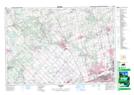
Maps showing Linton, York, Ontario
Linton is a Unincorporated area located in York, Ontario and has an elevation of 317 meters.
- Latitude: 43° 57' 23'' North (decimal: 43.9563888)
- Longitude: 79° 39' 55'' West (decimal: -79.6652777)
- Topography Feature Category: Unincorporated area
- Geographical Feature: Dispersed Rural Community
- Canadian Province/Territory: Ontario
- Elevation: 317 meters
- Location: York
- Atlas of Canada Locator Map: Linton
- GPS Coordinate Locator Map: Linton Lat/Long