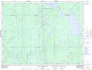
Maps showing Little Abitibi Lake, Cochrane, Ontario
Little Abitibi Lake is a Lake located in Cochrane, Ontario and has an elevation of 264 meters.
- Latitude: 49° 24' 39'' North (decimal: 49.4108333)
- Longitude: 80° 32' 35'' West (decimal: -80.5430555)
- Topography Feature Category: Lake
- Geographical Feature: Lake
- Canadian Province/Territory: Ontario
- Elevation: 264 meters
- Location: Cochrane
- Atlas of Canada Locator Map: Little Abitibi Lake
- GPS Coordinate Locator Map: Little Abitibi Lake Lat/Long
Little Abitibi Lake NTS Map Sheets