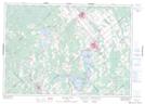
Maps showing Little Clyde River, Lanark, Ontario
Little Clyde River is a River located in Lanark, Ontario and has an elevation of 181 meters.
- Latitude: 45° 7' 5'' North (decimal: 45.1180555)
- Longitude: 76° 28' 30'' West (decimal: -76.4749999)
- Topography Feature Category: River
- Geographical Feature: River
- Canadian Province/Territory: Ontario
- Elevation: 181 meters
- Location: Lanark
- Atlas of Canada Locator Map: Little Clyde River
- GPS Coordinate Locator Map: Little Clyde River Lat/Long
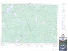
Little Clyde River NTS Map Sheets