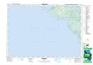
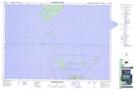
Maps showing Little Cove, Bruce, Ontario
Little Cove is a Bay located in Bruce, Ontario and has an elevation of 180 meters.
- Latitude: 45° 14' 59'' North (decimal: 45.2497222)
- Longitude: 81° 36' 41'' West (decimal: -81.6113888)
- Topography Feature Category: Bay
- Geographical Feature: Cove
- Canadian Province/Territory: Ontario
- Elevation: 180 meters
- Location: Bruce
- Atlas of Canada Locator Map: Little Cove
- GPS Coordinate Locator Map: Little Cove Lat/Long
Little Cove NTS Map Sheets