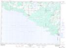
Maps showing Little Deans Bay, Manitoulin, Ontario
Little Deans Bay is a Bay located in Manitoulin, Ontario and has an elevation of 177 meters.
- Latitude: 45° 40' 37'' North (decimal: 45.6769444)
- Longitude: 82° 19' 7'' West (decimal: -82.3186111)
- Topography Feature Category: Bay
- Geographical Feature: Bay
- Canadian Province/Territory: Ontario
- Elevation: 177 meters
- Location: Manitoulin
- Atlas of Canada Locator Map: Little Deans Bay
- GPS Coordinate Locator Map: Little Deans Bay Lat/Long
Little Deans Bay NTS Map Sheets