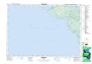
Maps showing Little Eagle Harbour, Bruce, Ontario
Little Eagle Harbour is a Bay located in Bruce, Ontario and has an elevation of 177 meters.
- Latitude: 45° 8' 55'' North (decimal: 45.1486111)
- Longitude: 81° 34' 50'' West (decimal: -81.5805555)
- Topography Feature Category: Bay
- Geographical Feature: Harbour
- Canadian Province/Territory: Ontario
- Elevation: 177 meters
- Location: Bruce
- Atlas of Canada Locator Map: Little Eagle Harbour
- GPS Coordinate Locator Map: Little Eagle Harbour Lat/Long
Little Eagle Harbour NTS Map Sheets