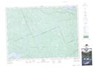
Maps showing Little Gilmour Creek, Nipissing, Ontario
Little Gilmour Creek is a River located in Nipissing, Ontario and has an elevation of 364 meters.
- Latitude: 46° 4' 57'' North (decimal: 46.0824999)
- Longitude: 78° 28' 3'' West (decimal: -78.4674999)
- Topography Feature Category: River
- Geographical Feature: Creek
- Canadian Province/Territory: Ontario
- Elevation: 364 meters
- Location: Nipissing
- Atlas of Canada Locator Map: Little Gilmour Creek
- GPS Coordinate Locator Map: Little Gilmour Creek Lat/Long