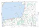
Maps showing Little Hell Hill, York, Ontario
Little Hell Hill is a Mountain located in York, Ontario and has an elevation of 243 meters.
- Latitude: 44° 16' 42'' North (decimal: 44.2783333)
- Longitude: 79° 20' 57'' West (decimal: -79.3491666)
- Topography Feature Category: Mountain
- Geographical Feature: Hill
- Canadian Province/Territory: Ontario
- Elevation: 243 meters
- Location: York
- Atlas of Canada Locator Map: Little Hell Hill
- GPS Coordinate Locator Map: Little Hell Hill Lat/Long
Little Hell Hill NTS Map Sheets