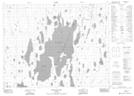
Maps showing Little Ligigami Bay, Cochrane, Ontario
Little Ligigami Bay is a Bay located in Cochrane, Ontario and has an elevation of 251 meters.
- Latitude: 50° 26' 38'' North (decimal: 50.4438888)
- Longitude: 80° 13' 2'' West (decimal: -80.2172222)
- Topography Feature Category: Bay
- Geographical Feature: Bay
- Canadian Province/Territory: Ontario
- Elevation: 251 meters
- Location: Cochrane
- Atlas of Canada Locator Map: Little Ligigami Bay
- GPS Coordinate Locator Map: Little Ligigami Bay Lat/Long
Little Ligigami Bay NTS Map Sheets