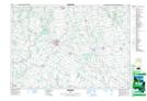
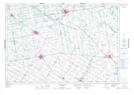
Maps showing Little Maitland River, Huron, Ontario
Little Maitland River is a River located in Huron, Ontario and has an elevation of 387 meters.
- Latitude: 43° 51' 35'' North (decimal: 43.8597222)
- Longitude: 81° 18' 32'' West (decimal: -81.3088888)
- Topography Feature Category: River
- Geographical Feature: River
- Canadian Province/Territory: Ontario
- Elevation: 387 meters
- Location: Huron
- Atlas of Canada Locator Map: Little Maitland River
- GPS Coordinate Locator Map: Little Maitland River Lat/Long
Little Maitland River NTS Map Sheets