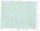
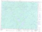
Maps showing Little Muskrat River, Thunder Bay, Ontario
Little Muskrat River is a River located in Thunder Bay, Ontario and has an elevation of 422 meters.
- Latitude: 49° 13' 26'' North (decimal: 49.2238888)
- Longitude: 88° 59' 53'' West (decimal: -88.9980555)
- Topography Feature Category: River
- Geographical Feature: River
- Canadian Province/Territory: Ontario
- Elevation: 422 meters
- Location: Thunder Bay
- Atlas of Canada Locator Map: Little Muskrat River
- GPS Coordinate Locator Map: Little Muskrat River Lat/Long
Little Muskrat River NTS Map Sheets