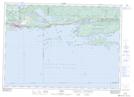
Maps showing Little Sandy Point, Algoma, Ontario
Little Sandy Point is a Cape located in Algoma, Ontario and has an elevation of 202 meters.
- Latitude: 46° 14' 53'' North (decimal: 46.2480555)
- Longitude: 82° 56' 22'' West (decimal: -82.9394444)
- Topography Feature Category: Cape
- Geographical Feature: Point
- Canadian Province/Territory: Ontario
- Elevation: 202 meters
- Location: Algoma
- Atlas of Canada Locator Map: Little Sandy Point
- GPS Coordinate Locator Map: Little Sandy Point Lat/Long