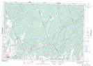
Maps showing Little Skootamatta Creek, Hastings; Lennox and Addington, Ontario
Little Skootamatta Creek is a River located in Hastings; Lennox and Addington, Ontario and has an elevation of 234 meters.
- Latitude: 44° 34' 29'' North (decimal: 44.5747222)
- Longitude: 77° 14' 26'' West (decimal: -77.2405555)
- Topography Feature Category: River
- Geographical Feature: Creek
- Canadian Province/Territory: Ontario
- Elevation: 234 meters
- Location: Hastings; Lennox and Addington
- Atlas of Canada Locator Map: Little Skootamatta Creek
- GPS Coordinate Locator Map: Little Skootamatta Creek Lat/Long