Canada Topographic Maps

Little Trout Creek Topo Maps

Topography maps and Latitude/Longitude Location

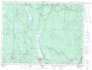
Maps showing Little Trout Creek, Ontario

Little Trout Creek is a River located in Ontario.

  • Latitude: 48° 56' 19'' North   (decimal: 48.9385999)
  • Longitude: 88° 19' 2'' West   (decimal: -88.3171999)
  • Topography Feature Category: River
  • Geographical Feature: Creek
  • Canadian Province/Territory: Ontario
  • GPS Coordinate Locator Map: Little Trout Creek Lat/Long

Little Trout Creek NTS Map Sheets

052A16 Red Rock Topographic Map at 1:50,000 scale

052H01 Nipigon Topographic Map at 1:50,000 scale

052A Thunder Bay Topographic Map at 1:250,000 scale

052H Nipigon Topographic Map at 1:250,000 scale

 
Buy Topographic Maps DVD
Newsletter Sign-up

Yes, I want to receive map store discounts.


Bookmark and Share