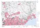
Maps showing Liverpool, Ontario, Ontario
Liverpool is a Unincorporated area located in Ontario, Ontario and has an elevation of 88 meters.
- Latitude: 43° 50' 27'' North (decimal: 43.8408333)
- Longitude: 79° 5' 16'' West (decimal: -79.0877777)
- Topography Feature Category: Unincorporated area
- Geographical Feature: Compact Rural Community
- Canadian Province/Territory: Ontario
- Elevation: 88 meters
- Location: Ontario
- Atlas of Canada Locator Map: Liverpool
- GPS Coordinate Locator Map: Liverpool Lat/Long