Maps showing Long Bank, Algoma, Ontario
Long Bank is a Shoal located in Algoma, Ontario.
- Latitude: 46° 16' 14'' North (decimal: 46.2705555)
- Longitude: 83° 44' 34'' West (decimal: -83.7427777)
- Topography Feature Category: Shoal
- Geographical Feature: Bank
- Canadian Province/Territory: Ontario
- Location: Algoma
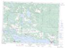
- Atlas of Canada Locator Map: Long Bank
- GPS Coordinate Locator Map: Long Bank Lat/Long
Long Bank NTS Map Sheets