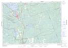
Maps showing Long Island Shoal, Muskoka, Ontario
Long Island Shoal is a Shoal located in Muskoka, Ontario.
- Latitude: 44° 48' 57'' North (decimal: 44.8158333)
- Longitude: 79° 23' 5'' West (decimal: -79.3847222)
- Topography Feature Category: Shoal
- Geographical Feature: Shoal
- Canadian Province/Territory: Ontario
- Location: Muskoka
- Atlas of Canada Locator Map: Long Island Shoal
- GPS Coordinate Locator Map: Long Island Shoal Lat/Long
Long Island Shoal NTS Map Sheets