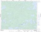
Maps showing Longlegged River, Kenora, Ontario
Longlegged River is a River located in Kenora, Ontario and has an elevation of 353 meters.
- Latitude: 50° 30' 56'' North (decimal: 50.5155555)
- Longitude: 93° 47' 22'' West (decimal: -93.7894444)
- Topography Feature Category: River
- Geographical Feature: River
- Canadian Province/Territory: Ontario
- Elevation: 353 meters
- Location: Kenora
- Atlas of Canada Locator Map: Longlegged River
- GPS Coordinate Locator Map: Longlegged River Lat/Long