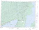
Maps showing Loon, Thunder Bay, Ontario
Loon is a Unincorporated area located in Thunder Bay, Ontario and has an elevation of 321 meters.
- Latitude: 48° 37' 56'' North (decimal: 48.6322222)
- Longitude: 88° 45' 54'' West (decimal: -88.7650000)
- Topography Feature Category: Unincorporated area
- Geographical Feature: Compact Rural Community
- Canadian Province/Territory: Ontario
- Elevation: 321 meters
- Location: Thunder Bay
- Atlas of Canada Locator Map: Loon
- GPS Coordinate Locator Map: Loon Lat/Long